Submarine Ship Control And Navigation Systems Parts

(Page 5) End item NSN parts page 5 of 24
Part Number
NSN
NIIN
065-001756-062 Electrical Insulation Sleeving
008715777
0683-2045 Composition Fixed Resistor
001367103
0684-2041 Composition Fixed Resistor
001367103
0686-5135 Composition Fixed Resistor
001410597
0686-5735 Composition Fixed Resistor
001410597
0689-1005 Composition Fixed Resistor
001048343
0693-1211 Composition Fixed Resistor
004723470
0698-5094 Composition Fixed Resistor
004356432
06990073 Electrical Connector Assembly
000648546
07-0701-9006 Electronic Shielding Gasket
012408049
07-0701-9006-30 Electronic Shielding Gasket
012408049
070-00064 Cartridge Fuse
005385472
0702077 Hexagon Head Cap Screw
001159526
0740586 Annular Ball Bearing
006796786
07506001130 Screw Thread Insert
012072838
0803199 Electrical Wire
004456504
0826V039 Hexagon Head Cap Screw
001159526
093D1077-101 Electronic Module
011588874
09ND36-080 Spline Self-locking Nut
010678549
1 1-4IN SIZEB N Fluid Filter
012031248
Page: 5 ...

Submarine Ship Control And Navigation Systems

Picture of Submarine Ship Control And Navigation Systems

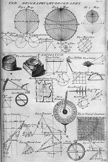
Navigation is a field of study that focuses on the process of monitoring and controlling the movement of a craft or vehicle from one place to another.

It is also the term of art used for the specialized knowledge used by navigators to perform navigation tasks. All navigational techniques involve locating the navigator's position compared to known locations or patterns.

Navigation, in a broader sense, can refer to any skill or study that involves the determination of position and direction. For information about different navigation strategies that people use, visit human navigation.

In the European medieval period, navigation was considered part of the set of seven mechanical arts, none of which were used for long voyages across open ocean. Polynesian navigation is probably the earliest form of open ocean navigation, it was based on memory and observation recorded on scientific instruments like the Marshall Islands Stick Charts of Ocean Swells. Early Pacific Polynesians used the motion of stars, weather, the position of certain wildlife species, or the size of waves to find the path from one island to another.

지금 비교»
맑다 | 숨기다